Airlines with direct flights from Brasília International Airport to Pinto Martins International Airport
Gol
low cost airline
Sunday
Monday
Tuesday
Wednesday
Thursday
Friday
Saturday
low cost airline
1-2 daily flights
LATAM Airlines
Sunday
Monday
Tuesday
Wednesday
Thursday
Friday
Saturday
3-4 daily flights
Non-stop flights schedule from Brasília to Fortaleza
By browsing through the calendar, you can view all direct flight departures from Brasília International Airport to Pinto Martins International Airport across various airlines. Simply select a timetable to access a list of flights, or make a search to find the most competitive prices.
Flights Schedule
Airline
Flight
Mon
Tue
Wed
Thu
Fri
Sat
Sun
Gol
G3 1708
Su
—
Mo
08:50
Tu
08:50
We
08:50
Th
08:50
Fr
08:50
Sa
08:50
Gol
G3 1710
Su
20:50
Mo
20:50
Tu
—
We
20:50
Th
20:50
Fr
20:50
Sa
20:50
LATAM Airlines
LA 3670
Su
08:15
Mo
08:15
Tu
08:15
We
08:15
Th
08:15
Fr
08:15
Sa
08:15
LATAM Airlines
LA 3672
Su
11:50
Mo
11:50
Tu
12:40
We
12:20
Th
12:40
Fr
12:40
Sa
12:40
LATAM Airlines
LA 3676
Su
16:55
Mo
16:55
Tu
—
We
—
Th
—
Fr
—
Sa
15:50
LATAM Airlines
LA 3674
Su
20:15
Mo
20:15
Tu
20:15
We
20:15
Th
20:15
Fr
20:15
Sa
20:15
Brasília to Fortaleza direct flight price statistics
For those looking for the most affordable option, a direct flight from Brasília International Airport to Pinto Martins International Airport can be found for as little as 154$, with the cheapest time to fly being in October. The average prices for direct flights between Brasília International Airport (BSB) and Pinto Martins International Airport (BSB) are determined based on user searches and calculated from the lowest prices found per month for a round-trip ticket with a single adult. Please note that the prices may vary depending on the amount of data available for this particular route.
$360Approximately
$483Jan
$391Feb
$411March
$444April
$1106May
$191June
$176July
$168Aug
$170Sep
$154Oct
$154Nov
$481Dec
Approximate prices for a flight between Brasília International Airport (BSB) and Pinto Martins International Airport (BSB)
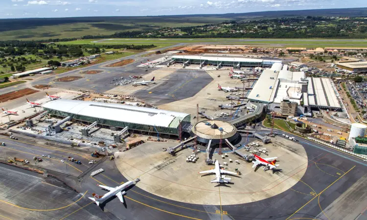
Departing from Brasília International Airport (BSB)
Presidente Juscelino Kubitschek (BSB) is the fifth largest airport in Brazil and is based in Brasilia.
Below, you'll find a comprehensive list of the different aircraft types that operate on this particular route, along with details on their seat capacity and available classes.
Boeing 737MAX 8 Passenger
Gol
183 seats(all economy)
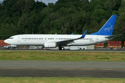
Boeing 737-800 Passenger
Gol
186 seats(all economy)
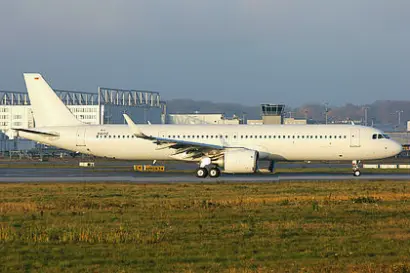
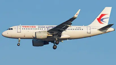
Airbus A321
LATAM Airlines
200 seats(all economy)
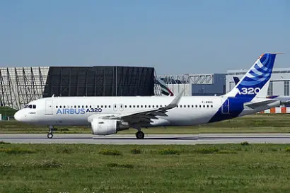
Airbus A320
LATAM Airlines
174 seats(all economy)
Airbus A319
LATAM Airlines
143 seats(all economy)
Brasília (BSB) to Fortaleza (FOR) : Flight information
What is the duration of the flight from Brasília to Fortaleza?
Usually, it takes 2h 40min to fly from Brasília International Airport (BSB) to Pinto Martins International Airport (FOR)
How many airlines offer nonstop flights between Brasília and Fortaleza?
2 airline(s): Gol, LATAM Airline provide nonstop flights to Pinto Martins International Airport (FOR).
What is the typical flight cost from Brasília to Fortaleza?
The lowest fare for a direct flight between Brasília International Airport and Pinto Martins International Airport is 154$, and you can get it in October. Flight prices rise in May and the average price for a non-stop flight is 1106$
What is the most popular airline on this route?
The most well-known airline operating direct flights between Brasília to Fortaleza is Gol.
How far is it to fly between Brasília to Fortaleza?
The shortest distance is 1699 kilometers.
Our advantages
100% Free
Europefly is a free platform, so you can begin saving right now.
Book with Flexibility
Plan your travels in advance without and find flights with no changes fees
Travel smart
Every year, we assist millions of people with their flight requirements. Our platform offers valuable insights and data-driven charts, which can aid in making informed decisions and simplify travel planning.
Reviews
4(14234 reviews)
Emma
5
My preferred website for comparing flight options is Europefly. Frequently, the prices available on this platform are lower than those found on airline websites.
Markus
4
Europefly is straightforward and user-friendly. It is highly recommended for people who wish to visit their hometown or explore different countries for vacation purposes.
Elena
5
The pricing offered by Europefly is exceptionally competitive, and they provide additional options that are not available on many other sites. As a result, I was able to save a considerable amount of money.
Kimberly
5
Europefly provides a fast and efficient service that allows us to compare flight prices quickly and easily book our tickets. The availability of flights is also displayed, which is extremely beneficial. Overall, the platform is helpful and user-friendly.
Simona
5
I had an excellent experience using this platform to find the best ticket that offered a perfect balance of cost and travel time. It has become my preferred website for searching flight tickets.
Kim
4
I have previously used Europefly, and it has always been a hassle-free and efficient experience. I plan to continue using the platform for future bookings.
Elizabeth
4
I was pleased with the outcome of my search for a flight and found a reasonable price through this platform. I have consistently used this site to book my international flights.