Low-Cost Direct Flights from Murtala Muhammed International Airport (LOS) to Nnamdi Azikiwe International Airport (ABV)
Are you looking for affordable and convenient travel options between Lagos and Abuja? Look no further! Several airlines offer low-cost direct flights from Murtala Muhammed International Airport (LOS) to Nnamdi Azikiwe International Airport (ABV), making your journey quick and budget-friendly.
Airlines Operating on this Route:
Air Peace: Air Peace, a popular Nigerian airline, provides direct flights between Lagos and Abuja. Known for its excellent service and competitive prices, Air Peace offers a convenient travel option for passengers.
Dana Air: Dana Air is another airline that operates direct flights on the LOS-ABV route. With a focus on safety and customer satisfaction, Dana Air ensures a pleasant flying experience for travelers.
Arik Air: Arik Air, a leading Nigerian carrier, also offers low-cost direct flights between Murtala Muhammed International Airport and Nnamdi Azikiwe International Airport. Passengers can enjoy reliable service and affordable fares when choosing Arik Air for their journey.
Whether you are traveling for business or leisure, these airlines provide a range of options to suit your schedule and budget. Say goodbye to long layovers and unnecessary expenses – book a direct flight from LOS to ABV and enjoy a hassle-free travel experience.
Cimber AS
Sunday
Monday
Tuesday
Wednesday
Thursday
Friday
Saturday
2-3 daily flights
Non-stop flights schedule from Uyo to Abuja
By browsing through the calendar, you can view all direct flight departures from Akwa Ibom Airport to Nnamdi Azikiwe International Airport across various airlines. Simply select a timetable to access a list of flights, or make a search to find the most competitive prices.
Flights Schedule
Airline
Flight
Mon
Tue
Wed
Thu
Fri
Sat
Sun
Cimber AS
QI 200
Su
—
Mo
08:00
Tu
08:00
We
08:00
Th
08:00
Fr
08:00
Sa
08:00
Cimber AS
QI 206
Su
12:00
Mo
—
Tu
—
We
—
Th
—
Fr
—
Sa
—
Cimber AS
QI 202
Su
—
Mo
14:00
Tu
14:00
We
14:00
Th
14:00
Fr
14:00
Sa
—
Cimber AS
QI 204
Su
16:00
Mo
16:00
Tu
16:00
We
16:00
Th
16:00
Fr
16:00
Sa
16:00
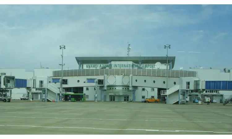
Departing from Akwa Ibom Airport (QUO)
Akwa Ibom Airport (QUO) is a smaller airport based in Uyo, Nigeria.
Below, you'll find a comprehensive list of the different aircraft types that operate on this particular route, along with details on their seat capacity and available classes.
How much time does it take to fly from Akwa Ibom Airport to Nnamdi Azikiwe International Airport?
The average flight time between Akwa Ibom Airport and Nnamdi Azikiwe International Airport typically takes 1h 15min
How many airlines offer nonstop flights between Uyo and Abuja?
1 airline(s): Cimber A provide nonstop flights to Nnamdi Azikiwe International Airport (ABV).
How much does it usually cost to fly from Uyo to Abuja?
You can fly directly from Akwa Ibom Airport and Nnamdi Azikiwe International Airport for only 0$ if you book in -. A non-stop flight will cost you 0$ in -, when flight prices are higher.
What is the most popular airline on this route?
The most well-known airline operating direct flights between Uyo to Abuja is Cimber AS.
What is the flight travel distance from Uyo to Abuja?
Distance from Uyo to Abuja is approximately 459 kilometers
Our advantages
100% Free
Europefly is a free platform, so you can begin saving right now.
Book with Flexibility
Plan your travels in advance without and find flights with no changes fees
Travel smart
Every year, we assist millions of people with their flight requirements. Our platform offers valuable insights and data-driven charts, which can aid in making informed decisions and simplify travel planning.
Reviews
4(14234 reviews)
Emma
5
My preferred website for comparing flight options is Europefly. Frequently, the prices available on this platform are lower than those found on airline websites.
Markus
4
Europefly is straightforward and user-friendly. It is highly recommended for people who wish to visit their hometown or explore different countries for vacation purposes.
Elena
5
The pricing offered by Europefly is exceptionally competitive, and they provide additional options that are not available on many other sites. As a result, I was able to save a considerable amount of money.
Kimberly
5
Europefly provides a fast and efficient service that allows us to compare flight prices quickly and easily book our tickets. The availability of flights is also displayed, which is extremely beneficial. Overall, the platform is helpful and user-friendly.
Simona
5
I had an excellent experience using this platform to find the best ticket that offered a perfect balance of cost and travel time. It has become my preferred website for searching flight tickets.
Kim
4
I have previously used Europefly, and it has always been a hassle-free and efficient experience. I plan to continue using the platform for future bookings.
Elizabeth
4
I was pleased with the outcome of my search for a flight and found a reasonable price through this platform. I have consistently used this site to book my international flights.