Low-Cost Airlines with Non-Stop Flights from Phu Cat Airport (UIH) to Noi Bai International Airport (HAN)
Are you looking for an affordable and convenient way to travel between Phu Cat Airport (UIH) and Noi Bai International Airport (HAN)? Look no further! Several low-cost airlines offer non-stop flights on this route, making your journey smooth and hassle-free.
Here are some of the airlines that operate non-stop flights between Phu Cat Airport and Noi Bai International Airport:
Jetstar Pacific: Jetstar Pacific is a popular choice for budget travelers, offering reliable service and competitive prices on their non-stop flights between UIH and HAN.
VietJet Air: VietJet Air is known for its affordable fares and modern fleet. Travelers can enjoy a comfortable journey on VietJet Air's non-stop flights between the two airports.
Bamboo Airways: Bamboo Airways is a relatively new player in the airline industry but has quickly gained popularity for its low-cost flights and excellent service. Passengers can fly non-stop from Phu Cat Airport to Noi Bai International Airport with Bamboo Airways.
Whether you are traveling for business or leisure, these low-cost airlines provide a convenient and cost-effective way to reach your destination. Sit back, relax, and enjoy a seamless journey from Phu Cat Airport to Noi Bai International Airport with these reputable airlines.
VietJet Air
low cost airline
Su
Mo
Tu
We
Th
Fr
Sa
low cost airline
1 daily flights
Vietnam Airlines
business available
Su
Mo
Tu
We
Th
Fr
Sa
business available
1 daily flights
Bamboo Airways
business available
Su
Mo
Tu
We
Th
Fr
Sa
business available
3 daily flights
VECA
Su
Mo
Tu
We
Th
Fr
Sa
1 daily flights
Non-stop flights schedule from Qui Nhon to Hanoi
The Phu Cat Airport calendar provides a comprehensive overview of all direct flight departures. With the help of the calendar, you can quickly and easily explore all the available flights to Nội Bài International Airport. If you find a suitable timetable, simply click on it to access a list of flights. Alternatively, you can make a search to compare and find the best prices for your desired destination.
Flights Schedule
Airline
Flight
Mon
Tue
Wed
Thu
Fri
Sat
Sun
VietJet Air
VJ 432
Su
08:30
Mo
08:30
Tu
08:30
We
08:30
Th
08:30
Fr
08:30
Sa
08:30
Vietnam Airlines
VN 1622
Su
13:25
Mo
13:25
Tu
13:25
We
13:25
Th
13:25
Fr
13:25
Sa
13:25
Bamboo Airways
QH 1212
Su
11:20
Mo
11:20
Tu
11:20
We
11:20
Th
11:20
Fr
11:20
Sa
11:20
Bamboo Airways
QH 1214
Su
15:30
Mo
15:30
Tu
15:30
We
15:30
Th
15:30
Fr
15:30
Sa
15:30
Bamboo Airways
QH 1216
Su
18:40
Mo
18:40
Tu
18:40
We
18:40
Th
18:40
Fr
18:40
Sa
18:40
VECA
VU 202
Su
14:35
Mo
14:35
Tu
14:35
We
14:35
Th
14:35
Fr
14:35
Sa
14:35
Qui Nhon to Hanoi non-stop flight price statistics
This graph provides insight into the average prices for direct flights between Phu Cat Airport (UIH) and Nội Bài International Airport (UIH). The prices are based on user searches and are calculated using the cheapest fares found each month for a round-trip ticket with one adult passenger. It's important to note that these prices are subject to change and may vary based on the availability of data for this particular route. Nonetheless, this information can be an invaluable resource for anyone looking to plan their travels and stay within a specific budget. By utilizing this tool, you can gain valuable insights into the most cost-effective times to travel and secure the best possible deals on flights between these two destinations.
€54Approximately
€94Jan
€77Feb
€80Mar
€87Apr
€123May
€105Jun
€90Jul
—Aug
—Sep
—Oct
—Nov
—Dec
Approximate prices for a flight between Phu Cat Airport (UIH) and Nội Bài International Airport (UIH)
Departing from Phu Cat Airport (UIH)
Qui Nhon Airport (UIH) is a smaller airport located in Vietnam, serving the coastal city of Qui Nhon and offering limited domestic flights.
Noibai International Airport (HAN), located in Hanoi, is Vietnam's second largest airport, serving as a key hub for both domestic and international flights.
Below, you'll find a comprehensive list of the different aircraft types that operate on this particular route, along with details on their seat capacity and available classes.
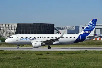
Airbus A320
VietJet Air
180 seats(all economy)
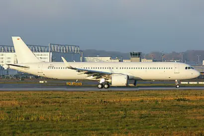
Airbus A321
Vietnam Airlines
186 seats(all economy)
Airbus A321
Bamboo Airways
192 seats(all economy)
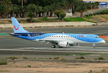
Embraer 190
Bamboo Airways
98 seats(all economy)
Airbus A321
VECA
217 seats(all economy)
Qui Nhon (UIH) to Hanoi (HAN) : Flight information
What is the duration of the flight from Qui Nhon to Hanoi?
Usually, it takes 1h 50m to fly from Phu Cat Airport (UIH) to Nội Bài International Airport (HAN)
How many airlines offer nonstop flights between Qui Nhon and Hanoi?
4 airline(s): VietJet Air, Vietnam Airlines, Bamboo Airways, VEC provide nonstop flights to Nội Bài International Airport (HAN).
What is the typical flight cost from Qui Nhon to Hanoi?
The lowest fare for a direct flight between Phu Cat Airport and Nội Bài International Airport is 0€, and you can get it in August. Flight prices rise in May and the average price for a non-stop flight is 123€
Which airline is the most in-demand on this route?
VietJet Air is the most popular airline with direct flights between Qui Nhon to Hanoi.
What is the flight travel distance from Qui Nhon to Hanoi?
Distance from Qui Nhon to Hanoi is approximately 882 kilometers
Our advantages
100% Free
Europefly is a free platform, so you can begin saving right now.
Book with Flexibility
Plan your travels in advance without and find flights with no changes fees
Travel smart
Every year, we assist millions of people with their flight requirements. Our platform offers valuable insights and data-driven charts, which can aid in making informed decisions and simplify travel planning.
Reviews
4(14234 reviews)
Emma
5
My preferred website for comparing flight options is Europefly. Frequently, the prices available on this platform are lower than those found on airline websites.
Markus
4
Europefly is straightforward and user-friendly. It is highly recommended for people who wish to visit their hometown or explore different countries for vacation purposes.
Elena
5
The pricing offered by Europefly is exceptionally competitive, and they provide additional options that are not available on many other sites. As a result, I was able to save a considerable amount of money.
Kimberly
5
Europefly provides a fast and efficient service that allows us to compare flight prices quickly and easily book our tickets. The availability of flights is also displayed, which is extremely beneficial. Overall, the platform is helpful and user-friendly.
Simona
5
I had an excellent experience using this platform to find the best ticket that offered a perfect balance of cost and travel time. It has become my preferred website for searching flight tickets.
Kim
4
I have previously used Europefly, and it has always been a hassle-free and efficient experience. I plan to continue using the platform for future bookings.
Elizabeth
4
I was pleased with the outcome of my search for a flight and found a reasonable price through this platform. I have consistently used this site to book my international flights.